
Bridgeton ZIP Directory Coverage
ZIP 08302 is Bridgeton's postal core. The official postal result identifies the Bridgeton Post Office and supports using 08302 as a delivery and last-line city reference. Nearby ZIPs belong to nearby postal areas, not automatic Bridgeton City coverage. The table keeps the known Bridgeton postal evidence separate from areas whose precise carrier boundaries were not established in the research.
| ZIP | Areas Covered | Post Office | Notes |
|---|---|---|---|
| 08302 | Primary Bridgeton postal area | Bridgeton Post Office | Use as a postal filter, not a legal city boundary. |
| 08320 | Nearby Cumberland postal area | Fairton Post Office | Do not count every 08320 address as Bridgeton City or a Bridgeton parcel. |
| 08323 | Nearby Greenwich postal area | Greenwich Post Office | Regional mailing context does not settle Bridgeton municipal jurisdiction. |
| 08353 | Nearby Cumberland postal area | Shiloh Post Office | It is not Bridgeton City solely because it is in Cumberland County. |
| 08311 / 08345 | Postal Bulletin service-table references | Exact local coverage not verified | Treat as a boundary research gap, not Bridgeton coverage. |
USPS Postal Bulletin material references 08311 and 08345 among nearby Bridgeton entries, but the available excerpt does not establish carrier routes or Bridgeton parcel-level coverage. A complete ZIP database or map inspection is still needed before assigning either one to a local neighborhood.
Bridgeton ZIP Postal Core
The official USPS Bridgeton location result places the Bridgeton main post office at 102 W Broad Street, Bridgeton, NJ 08302-9998. It lists 856-451-6100, retail hours of Monday through Friday 8:30–5 and Saturday 8:30–12:15, plus carrier, general delivery, and PO box services. USPS also identifies Fairton, Greenwich, and Shiloh as nearby alternatives.
The USPS location result is the source for this Bridgeton postal reference.
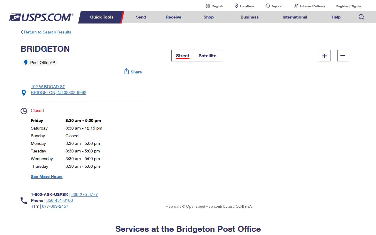
Postal verification answers a delivery question. It does not show resident names, define a municipal line, or replace a Bridgeton parcel record. Keep the formatted address and returned ZIP with the next lookup so a later record can be compared without changing the input.
Bridgeton ZIP Neighbor Areas
08320, 08323, and 08353 are useful caution points. USPS lists Fairton, Greenwich, and Shiloh as nearby alternatives to the Bridgeton post office. They are part of the Bridgeton postal landscape, but each can point beyond Bridgeton City. A familiar county name or a nearby post office is not enough to attach a property, city record, or street address to Bridgeton.
Bridgeton itself has 6.23 square miles of land according to Census QuickFacts, yet its Bridgeton municipal footprint and a postal service area are different shapes. This is why a postal directory should first narrow the address, then move to municipality and parcel tools. The boundary check is especially important for an address that uses a Bridgeton last line but may be outside the city.
Note: Nearby postal service is useful for routing mail, but it is not evidence of city jurisdiction.
Bridgeton East Side Postal Story
Bridgeton's postal history has one useful local change. A 2011 USPS Postal Bulletin reports that the East Side classified station was discontinued on February 25, 2011 while ZIP 08302 remained at the Main Office. An old Bridgeton directory, envelope, or local account may therefore name a station or neighborhood label that is no longer a current USPS facility.
This did not redraw Bridgeton City. It was a postal facility change with 08302 retained at the main office. When an older source uses an unfamiliar station name, preserve that wording in Bridgeton address notes and compare it with the current USPS address before deciding that the address itself changed.
Finding a Bridgeton ZIP Address
No local public record source inspected for Bridgeton offered a verified ZIP-only resident filter. The safer Bridgeton workflow starts with the specific address, not a ZIP-wide name search. USPS can check delivery and the last-line city; the State's municipality form then checks the jurisdictional side. Property Explorer, the assessor, county GIS, and the Clerk each answer a different part of the address question.
- Record the full Bridgeton address exactly as supplied, including apartment or directional details where present.
- Use the USPS result to confirm the Bridgeton delivery format and retain the returned postal ZIP.
- Run the address through the New Jersey municipality lookup with the ZIP as an optional check for a Bridgeton address.
- Compare the municipality result with the postal last line. Do not force a nearby address into Bridgeton.
- Search New Jersey Property Explorer by address, or by Cumberland County, Bridgeton City, block, and lot when needed.
- Use the Bridgeton assessor card and recorded deed for parcel or legal-description confirmation.
Once a ZIP has narrowed the area, the Bridgeton Street Directory has the address-keyed record trail. Narrowing a Bridgeton search by ZIP is a geographic starting point, not a replacement for that street-level work.
Bridgeton ZIP Municipality Check
For a Bridgeton border address, the New Jersey municipality lookup provides the best official bridge between a postal address and municipality. Its captured form accepts an address, street, city, and optional ZIP. It should be used with USPS rather than instead of USPS because each tool answers a different question.
| Field | Use for a Bridgeton ZIP check |
|---|---|
| Address | Enter the supplied street-number address for the standardized jurisdiction lookup. |
| Street | Use the street name when checking an address component or variant. |
| City | Compare the entered city context with the municipality returned for the Bridgeton address by the official tool. |
| ZIP | Optional field that supports the postal comparison; it does not prove a city boundary. |
The official municipality lookup form is the source for this Bridgeton postal address screen.
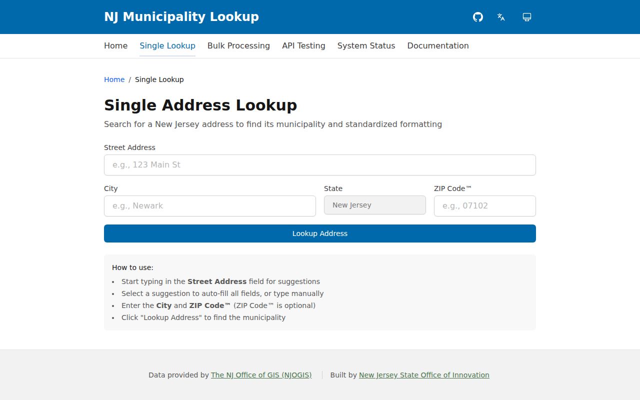
The result helps avoid a common error: treating a postal last-line city as the government jurisdiction that holds the property record. Use its result as a comparison point, then continue with the Bridgeton parcel and deed systems.
Bridgeton ZIP Boundary Limits
USPS delivery areas, Census ZIP Code Tabulation Areas, Bridgeton city limits, county boundaries, and municipality labels are separate geographies. The Census ZCTA guidance says a ZCTA approximates USPS delivery areas for statistics and is not a USPS legal boundary. It can support aggregate context, but USPS remains the delivery authority and Bridgeton records offices remain the source for municipal or parcel questions.
- ZIP code
- A postal routing code associated with delivery and post-office service, not a municipal boundary.
- ZIP+4
- An added four-digit delivery detail used with a ZIP code to refine postal routing for a particular segment or address.
- PO box ZIP
- A postal ZIP used for post-office box service. It should not be treated as a neighborhood or city-limit boundary.
- Unique ZIP
- A ZIP assigned to a single organization or high-volume recipient. No verified Bridgeton example was located in this research.
- Carrier route
- A postal delivery grouping. Exact Bridgeton carrier-route boundaries were not verified and should not be inferred from the ZIP alone.
Bridgeton ZIP Parcel Fallback
When the postal and municipality results differ, the parcel trail resolves the next question. New Jersey Property Explorer searches by address, county, municipality, block, and lot. Select Cumberland County and Bridgeton City where appropriate, then record the block, lot, and PIN. The map helps identify the parcel, but its geometry is not a legal survey and owner names may be redacted under Daniel's Law.
The Bridgeton Tax Assessor supplies the assessment context and property record-card route. Its owner mailing address can differ from the physical situs, so neither should be called an occupant address without another source. Cumberland County GIS adds parcel, road, zoning, land-use, and boundary layers. These tools identify where a record belongs; they do not create a household list from a ZIP.
For a city-side map question, Bridgeton Planning/Zoning Administration handles planning and zoning applications and map routes. It is at 50 E Broad Street. Planning/Zoning can explain current map context, while the assessor supplies the tax-record route and county GIS supplies the regional layers. Keep those roles separate, especially when a postal address sits near a municipal edge.
Cumberland County GIS is also the documented map and data-request gateway for parcel, road, zoning, wetland, waterway, soil, Census, boundary, preserved-land, and land-use layers. Its associated office is with the County Department of Planning, Tourism, and Community Affairs at the County Extension Center in Millville. Bridgeton questions may therefore move between the city office and a county-held map layer. The live GIS search controls were not fully captured, so do not claim a local ZIP filter that the research did not verify.
For an ownership or recorded-instrument question, use the Cumberland County Clerk land-record route. County Fusion covers 1987 to the present, ImageSync covers 1960–1987, and pre-1960 records require the Record Vault. A deed's legal description is stronger than a mailing ZIP when an old address is unclear.
Note: A ZIP filter on Property Explorer or a local assessor search was not verified during research, so use the captured address, county, municipality, block, and lot fields instead.
Bridgeton ZIP History Limits
ZIPs are weak keys for historical household work. Older directories and deeds use street names, numbers, block and lot, or legal descriptions rather than a current postal code. Bridgeton has added another challenge: official sources give different dates for the transition to the name Bridgeton, with references to Bridge-towne and Cohansey Bridge also appearing in historical context. Preserve each older name as a search variant rather than assuming a ZIP can bridge the period.
Street names can change as well. The city's 2025 ordinances list Pine and N Pine becoming James D Edwards Sr Way, and Bank Street with its extension becoming Jack Surrency Way. Check the adopted ordinance and use both names in the directory, GIS, and deed trail. A city directory or deed may retain the older street label even after the current postal address uses the new one.